Experts discuss the feasibility of an HN-1 satellite. [Photo by Sun Jing/Hainan Daily APP]
Hainan will launch its first satellite HN-1 in 2019, paving the way for cooperation between countries along the Maritime Silk Road, according to a meeting at the Sanya Institute of Remote Sensing on Aug 14.
Ten satellites will be successively launched into space by 2021 to build a satellite network above low-latitude regions.
Yang Tianliang, head of the institute and commander-in-chief and chief designer of the HN-1 satellite, said that Hainan has the largest marine area nationwide in which over 200 islands and reefs are within Hainan's administration. Therefore, remote sensing technology is required for the maritime safety and sovereignty of China.
After the satellite network is deployed, Hainan will be able to maintain around-the-clock surveillance over its territorial waters and islands. The move will also meet the requirements of fishing and maritime transportation.
The HN-1 is part of the project of a network of Hainan satellites initiated in 2015. The project will serve the Belt and Road Initiative and Hainan's blueprint of building itself into a major maritime power. The estimated cost of the project will reach 600 million yuan ($87.04 million).
On the panel at the meeting were 20 experts from national renowned universities and institutes.

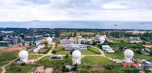
Multiple spherical antennas are deployed at the Sanya Institute of Remote Sensing. [Photo by Wu Wei/Hainan Daily APP]